Detailed Geography of District Kinnaur, Himachal Pradesh
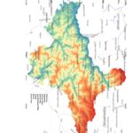
Geographical Location of District Kinnaur Kinnaur is eastern most district of Himachal Pradesh. Total area…
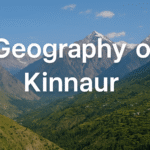
Geographical Location of District Kinnaur Kinnaur is eastern most district of Himachal Pradesh. Total area…

Geographical Location of District Chamba Physiography of District Chamba Physiographically district can be divided into…
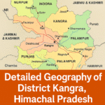
Geographical Location of District Kangra, Himachal Pradesh Total area of Kangra is 5739Km2 in term…
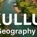
Geographical Location of District Kullu Below is Detailed map of District Kullu. Mountain Ranges of…
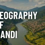
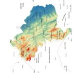
Description of District Mandi Mandi is central district of Himachal Pradesh. It is encircled by…
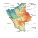
Geographical Description of District Shimla Completely nestled in Dhauladhar mountain range, Shimla is known for…
Named after Goddess Shoolini, district Solan is hilly tract covering area of 1936 Sq mtr….
Physical Location of District Hamirpur, Hamirpur, Himachal Pradesh Area wise district Hamirpur is the smallest…
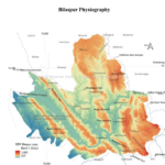
Location of District Bilaspur Total area of Bilaspur is 1167 Km2. Areas wise Bilaspur is…

Source: Himachal Pradesh Geography Through Maps and H.P. Geography by Pardeep Kumar. Content owned and…

Technical Note: The Chandrabhaga (Chenab) River catchment in Himachal Pradesh covers 7,789 sq km, calculated…
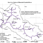
Origin of Ravi River, Himachal Pradesh. River Ravi originates in Barabhangal area of District Kangra…
Himachal Pradesh is a religious diverse state. Its mountain and villages host number of Devi…
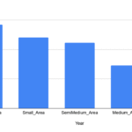
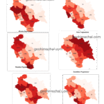
Total Landholding of Himachal Pradesh In Below given map you can see that Total Holding…
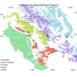
Location: A ) Physiographic Division:The state can be divided into four major physical divisions –…