The evolution of landforms is an ongoing and dynamic process, shaped by various natural and anthropogenetic factors. Landforms are primarily the result of tectonic activities, erosion, weathering, sedimentation, and other human-induced factors.Himalaya are young and Himachal Pradesh being part of it has many important Landforms.
| General Classification of Landforms First-Order Landforms: Major global features like continents, oceans, and large mountain ranges. Second-Order Landforms: Large, recognizable features within first-order landforms, such as mountain ranges, valleys, and plateaus. Third-Order Landforms: Smaller, more detailed features like hills, canyons, dunes, and cliffs. Fourth-Order Landforms: Very localized features like rills, gullies, sandbars, and potholes. |
Origin of Landforms
The collision between the Indian and Eurasian plates played a pivotal role in the formation of the Himalayan mountain range, leading to the development of high peaks, ridges, and valleys. The establishment of the Indian monsoon further influenced the shaping of these landforms by modifying climatic conditions, which, in turn, impacted erosion and sedimentation patterns. The global ice age also significantly contributed to landform development, particularly during the Pleistocene Epoch, when large glaciers covered vast portions of the Himalayas, leaving behind a range of important landforms.
While the Himalayas experienced their first ice age during the Miocene Epoch, it was during the Pleistocene Epoch that glaciers reached their maximum extent, significantly shaping the landscape thereby creating the important feature such as Valleys, Peaks, Arte, Cirque and lakes etc. Ongoing tectonic movement also play active role in shaping the Landforms of Himalaya
Mountain Ranges and Landforms
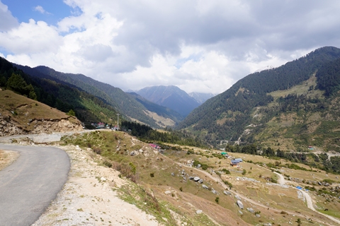
In the Lesser Himalayas and Shivalik, fluvial processes predominate, with rivers and streams carving out valleys and shaping the terrain through erosion and sediment deposition. In contrast, glacial erosion plays a more prominent role in the Higher Himalayas, where glaciers have shaped the landscape by forming U-shaped valleys, cirques, and moraines and others landforms.
| Timeline:- Pre-Ice Age (Before 2.6 million years ago): Early development of the Indian Monsoon system with the collision of the Indian and Eurasian plates. Early Pleistocene (2.6 million to 1 million years ago): Ice Age begins, and the Indian Monsoon system experiences weaker periods during glaciation. Mid to Late Pleistocene (1 million to 11,700 years ago): Glacial maximum, with fluctuating monsoon strength, affecting precipitation and glaciation in the Himalayas. End of Pleistocene (11,700 years ago): End of the Ice Age; warmer conditions lead to a strengthened monsoon, and glacial retreat in the Himalayas. Modern Era (20th Century to Present): Ongoing glacial retreat, with global warming affecting both the Indian Monsoon and glacier dynamics. |
Landforms of Himalaya are in initial stage of development with domination of sharp feature for example “V” shaped valleys , hanging valleys , Gorges and Peaks etc are prominent feature of Higher Himalaya. Landforms of higher Himalaya are more mature than Lesser Himalaya and Shivalik.
On the other hand the landforms of Shivalik are in initial stage of development. For example :- Summit Plain is very regular in Shivalik and irregular in Higher /lesser Himalaya which indicate that large valleys are yet to be carved out by rivers.Overall appearance of Shivalik hill is very dissected due to presence of soft rocks of relatively young age, on the other hand rocks of lesser Himalaya and Greater Himalaya are very resistant and old, consequently landforms are rounded and very stable.
| Note:- Landforms :-Individual natural features (mountains, valleys, etc.), Terrain :-the general surface characteristics or conditions of an area, which could include many different landforms.Landscape:- A landscape refers to the overall appearance or view of a stretch of land, including both natural and human-made features. It is a broad term that encompasses all the visible features in a given area. |
Hydrological system also vary significantly across the different mountain ranges. for examples :- Stream density is very high in Shivalik as compared to Lesser Himalaya and Greater Himalaya ranges which indicate an initial stage of development of hydrological system. Further river capturing is very intense in Shivalik hills, continuously shaping the landforms.
Himachal Pradesh and Landforms
Evolution Landforms such as Mountain ranges can be explained with collisions of Indo Eurasians Plates. However Second order landforms such as Valleys need detailed explanation. For example:- Major valleys such as Chandrabhaga, Ravi, Satluj and Kullu valleys are primarily products of river erosion ,where as Kangra valley which is broad open valley is product of tectonic movements. Similarly evolution of hanging valley such as Sangla valley of Greater Himalaya can be explained with Glacier activities. Similarly Towering Peaks are product of complex Glacier erosions and weathering process. Similarly river terrace are products of tectonic movements as well as river erosion.
Presence of fertile plains as such Kangra Outwash plains can be explained with Glacier advancement and retreat, while the evolution of Balh valley plains are linked with Paleo Beas channel and similarly Plains of Una and Sirmaur are also linked with river sedimentation. Thus origin of Landforms is complex process which involve many factors.
Uniqueness of Himachal Landforms
Himachal has very diverse climate with all major Himalayan mountain ranges. Shivalik foothills has Tropical like Climate in summer and Spiti has arctic like climate. Similarly Himachal has antecedent and subsequent both kind of rivers. Such a diverse condition produce variety of Landforms in small state like Himachal Pradesh which otherwise not present at one Place at same time. This make Himachal excellent state to studying Landforms. In Jammu and Kashmir you will not find Desert Landform, In Union Territory Ladhakh you will find only Desert and Glacio Landform, Similarly Uttarakhand and other Himalayan state lack one or other feature.
Important Landforms of Himachal Himalaya
- Valleys: Himachal has many significant V shaped and U shaped valleys. For example Satluj valley is product of erosion of river Satluj with continuous rise of Himalaya. Similarly Kullu valley is also carved out by river Satluj. Reader are advised to notice that valley are carved with combined effect of Tectonic rise of mountain range and simultaneously down cutting of river.
- Similarly Hanging valley such as Sangla Valley, Todang valley etc all are products of Glacier as well as fluvial erosion.
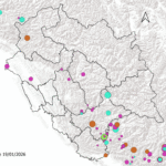
- Peak: Peak are prominent landform. They are shaped by Tectonic, Glacier and fluvial forces. For example- Hanuman Tibba famous peak of Kangra is located at meeting point of Dhauladhar mountain range and Pirpanjal Mountain range. Similarly many important peak like Inder Killa, Dibibokri Pyramid etc of Kullu all are located at Point where Greater Himalaya and Pirpanjal range meet, this explain the role of tectonic and glacier forces. ( See More Map of Important Peaks of Himachal Pradesh.)
- Lakes: Himachal have many prominent lakes. Lakes are products of Glacier, geological and anthropogenetic forces. Lamdal Lake of Chamba located at 4200Mt height of Dhauladhar mountain range is product of Glacier activities , it is good example of Paternoster lakes. Similarly Chander Tal and Suraj Tal both are developed due to local glacier activities.
- Similalry Rewalsar Lake, Dal Lake of Kangra, Renuka Lake of Sirmaur all are developed due to geological activities. Renuka Lake has been identified as paleo channel of river Giri that was dammed by Giri Thrust/Main Boundary Thrust. Similarly Dal lake and Kareri Lake all lies near Main Boundary thrust and formed due to activation of thrust.
- In Greater Himalaya and higher reaches of Lower Himalaya many number of Glacier Lakes can be found. Global warming has converted many Glaciers into Tarn Lake/Cirque lake. You can see these lake here.
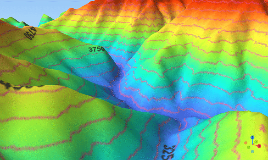
- ( See 3 D map : it help to understand why large Dam could only be build in Shivalik https://geohimachal.com/geovirtual-world/)
- Gorges: Himachal has two important Gorges such Shipki La Gorge (3000 m) and Larji Gorge (2050 m), former is product of Satluj river and later is product of Beas river. Gorges play important role in understanding Geological past. Larji Gorge is approximately 15 Km long and has height of 2050 m, this suggest Beas gorge must have created a Lake in present Kullu valley.
5. Waterfall :Origin of water is linked with Geological activities , most of water fall are located near Thrust points, where rocks are hard to carved out. For example Famous Bhagsu waterfall of Dharamshala is located near Main Boundary thrust, where there is difference in rock density.
6. River Terrace: River terrace constitute important part of river Landforms. In district Kangra river terrace are well developed along the course of rivers originating from Dhauladhar mountain. (See more here Kuhls of Kangra. A GIAHS Assessment. )
7. Plains: Although Himalaya lacks well developed plain but Shivalik and foothill of Lesser Himalaya has few important Plains. For Example- Outwash Plain of Kangra are studies worldwide for their origin and Irrigation system. These plains are product of glacio- fluvial activities of last ice age. Kangra Outwash Plains are the most exception of Landform of Himachal Pradesh. Balh Plain of Mandi have identified with paleo Beas river channel, it is believed that Beas once flowed into the Satluj and during this period Balh plain came into existence.
In Shivalik Una Plain, Indora Plains and Paonta Plains are prominent . All these plains are products of river deposition.
8. Cold Desert Landforms: These Landform are mainly found in District Lahaul Spiti and Poo area of Kinnaur. Here mushroom rocks and dry valleys are very common.
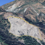
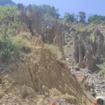
9. Badlands Topography: Shivalik is composed of many loosely assembles rocks, These rocks are very prone to weathering and produce variety of landforms. Most prominent location of these Landforms is Northern slope of Hathi Dhar , Near Chowari Chamba. Here you can almost find Escarpment, Rill, Gully, Hanging terrace, Pinnacle, Cave, Earth pillar, Mesa and butte like structure. ( You can see exact location here Google Earth Location )
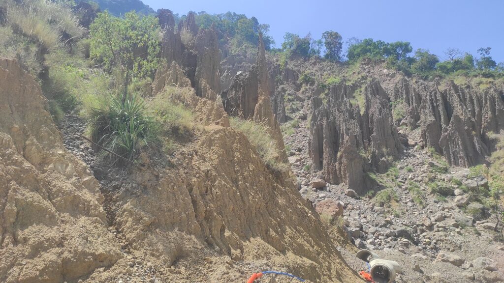
In Shivalik hill specially in Upper Shivalik these landform are very prominent. In district Una in local dialect ravine is called as “Choo“. These Choo are small water stream. ( See Here Geography of Una)
Other Local Landforms Puzzles
Apart from above Landforms , there are few minor landforms which surely puzzles almost all native of Himachal Pradesh, you must have hear these myths.
Large Boulder of Kangra Plains- These Boulder scatter around the agri field of Kangra near the foothill of Dhauladhar. Local people generally attribute them to unknown power, actually these large boulder were brought down by Glacier during the Pleistocene Ice age. If you notice their location , you will find that most of these boulder are located along the river or Nallah channel. Some Boulder are such a huge in size that people have constructed a religious site near them or in some case beneath them such as in Chamunda’s Shiv temple in Kangra.
Similarly there are many caves , the origin of which is again attributed to unknown supernatural power , however in reality these caves and nothing but sinkholes. You can find such sink hole in Sirmaur, Bilaspur ,Mandi and Kangra. Similarly there is cave near Gharela Near Palampur , it has Shiv temple and local people attribute its origin to Pandav, however this cave is carved into limestone or similar rocks.( Note – It is Still not studied from Geological Perspective)
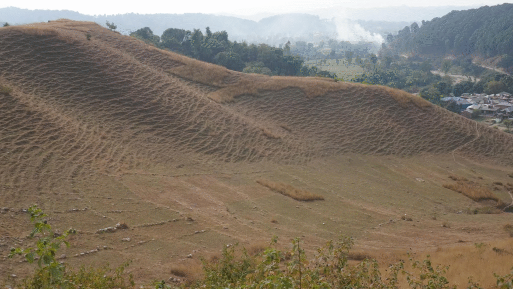
Terracette Patter: If you ever traveled in lower Himalaya or in Shivalik you must have notices this pattern, Terracette is product of Soil Creeping, animal and vegetation factors. Local people view it as part of so called Great Intelligence Design.
Conclusion
Himalaya landforms are continuously evolving. Geological, Glacier , Fluvial and anthropogenetic forces are actively shaping the regional landforms. In Shivalik erosion activities are dominant and in other part of Himalaya Glacier and Fluvial activities are shaping landforms. Landforms help us to understand regional Geology of area .
Which is Deepest Gorge of Himachal Pradesh ?
Shipki Gorge is the deepest gorge of Himachal Pradesh, with a depth of nearly 3000 metres, located along the Sutlej River near the India–China border.
Famous Tectonic Lakes of Himachal Pradesh ?
Renuka Lakes, Rewalsar Lakes etc are important Techtonic Lakes. Renuka Lake is located along the MBT fault. Rewalsar Lake, Dal Lake ,Kareri Lake all are formed in Thrust Trough.
In Which region of Himachal Pradesh Badland Landform can be seen predominately ?
Badland landforms in Himachal Pradesh are predominantly found in the Shivalik Hills, where soft rocks and heavy rainfall cause intense erosion.
Balh Plain of Mandi is example of ?
The Balh Plain of Mandi is an example of a flood plain formed by river deposition during repeated flooding events.
Which is Lake form the Paternoster formation in Himachal Pradesh
Lamdal Lake of Chamab formed the Paternoster Formation, where Seven Lakes are connecting which each other.
Which factor Play critical role in Lanform evolution in Shivalik ?
Hydrology Play critical role in Shivalik Landform Evolution. Shivalik rocks are soft and are easily eroded by Monsoon rain.
